
Milan does not have a reputation for being a green, environmental city. Tall houses, narrow streets, few parks, not too many trees… Sure, that’s exaggerated. It’s a very cool city to visit in itself. But it’s not the place that nature seekers would go for intuitively. And yet with just a little effort, Milan offers a lot of nature in short distance.
In June, I had my best friends over for an extended weekend. They had been in Milan previously, so we didn’t bother much about exploring the city. As the weather was sunny and stable, they just wanted to swim. And I wanted to show them some of my favorite places at the last occasion of doing so.
Quick note on the video: there’s one bit where the music covers up my voice. That’s around 1min40 into the video. I can’t open the editing file anymore for some strange reason, so we need to live with that. Basically I just say that it’s mostly a shadowy hike through the forest.
Friday: Camogli – (boat) – San Fruttuoso – (hike) – Portofino
While I’m not much of a beach person, also I enjoy the occasional day at the sea. Th ex-girl introduced me to a corner of the Ligurian coast that I came to appreciate. I also already took my Mum on a hike there. It’s one of the few places where I just go back and repeat the same thing. Usually I seek for diversity.
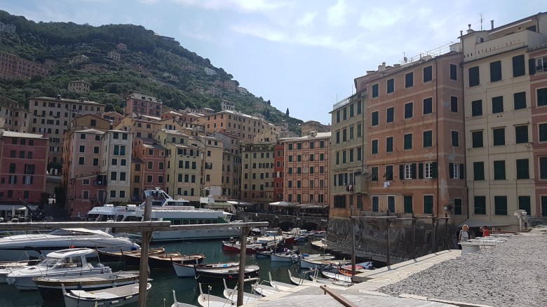
As always, I parked the car in Camogli. We then strolled around this little seaside town. Especially on a Friday at the beginning of the season, it’s a very quiet spot. The buildings don’t look much different from Cinqueterre. Take it as an opportunity to skip the masses.
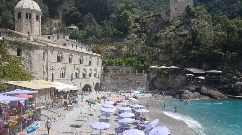
From Camogli, boats go to the San Fruttuoso abbey. That place looks like you would imagine a pirate shelter: a tiny bay, huge rock cliffs, easy to defend, and on a small beach a few scattered houses. There’s two restaurants for those who are hungry, a museum inside the abbey, and beautifully blue water. It’s in application for UNESCO World Heritage status, by the way. And you can get married there.
You could also hike from Camogli to San Fruttuoso. The trail has a reputation of being a bit challenging. We therefore hiked from San Fruttuoso to the next village, Portofino. Here, the challenge is only in the initial 200m of elevation gain. It’s steeper from the San Fruttuoso side, but more in the shadow. At the highest point, there’s a small picknick area. A tiny path leads to a view point. Careful: that one is only 50m long, but steep. A metal rope provides assistance.
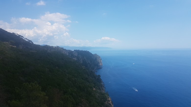
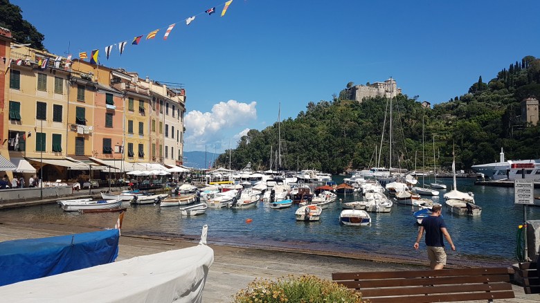
Portofino then gradually approaches. The hike itself is not very busy, but Portofino is. Hidden among the crowds must be the few (very) rich people who own the fancy boats floating in the bay. We celebrated the end of the trip with gelato. Buses and boats connect it with other places at the bay. From one of those we took the train back to Camogli.
The hike between San Fruttuoso and Portofino shall take about 90min. On three occasions, I’ve never made it in less than two hours.
Saturday: Hiking up to Rifugio Rosalba (Piani dei Resinelli), Lecco
Lecco is the city at the Southeastern end of Lago di Como. For the majority, it’s at most a stop on the way to Varenna and Bellagio. Italians who paid attention in school might remember Lecco and the neighboring Resegone mountains from their literature lessons. I think it’s makes for a nicer place in itself than Como. Lecco has the better gelaterias. The lake shore is also more rough around Lecco. You get a flair of rock formations like in the Dolomites – just at 1,000m less altitute.
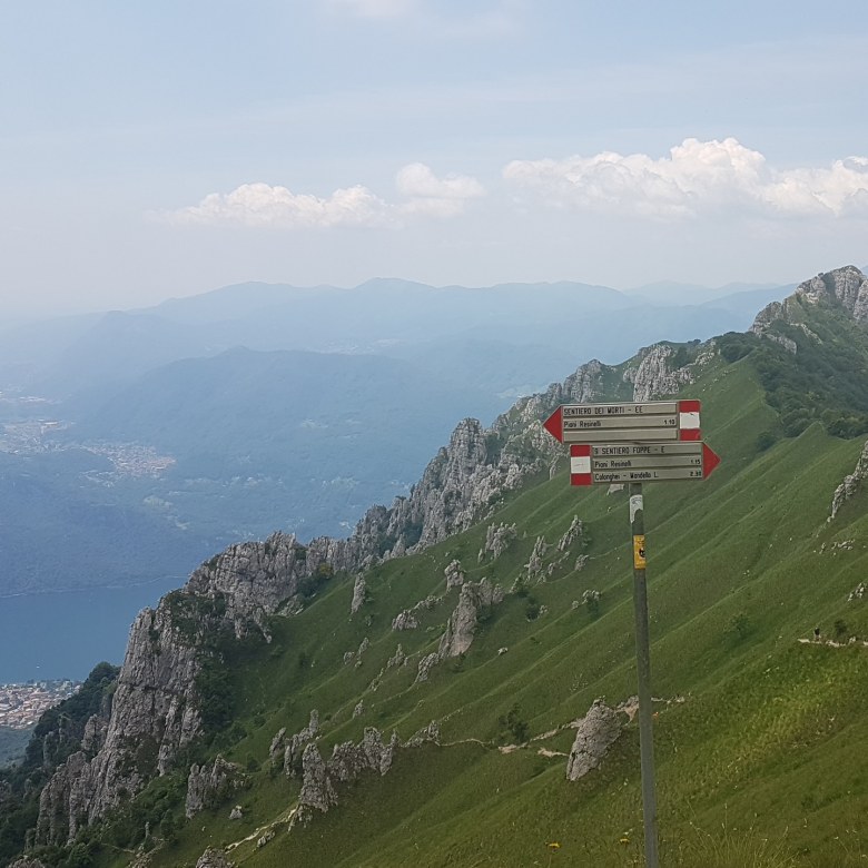
The hike between Piani dei Resinelli and Rifugio Rosalba is one of the most popular routes. There’s a big parking, but come early: there’s also big demand. At the beginning, you walk through the colony of holiday houses that popped up here in the 1960s to 1980s. There used to be some skiing facilities. Global warming, not enough space for development, and some other factors did their work: nothing is left of it.
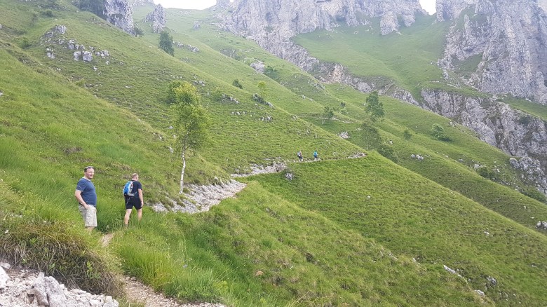
There are two-and-a-half routes up to Rifugio Rosalba. The more difficult way is the more stunning option. At elevation, it leads right through the rocks. There are ropes, bars, and ladders. We chose the easier path (follow the signs which call it Sentiero delle Foppe). This one splits half-way up the standard path and in a more direct, more steep, more exposed way. (It’s called path of the death – there might be a reason to it.) At that point, you get a feeling that the standard path is challenging enough. Steps are big and we needed our hands both going up and down. Nothing was dangerous, but a lot demanded a bit more physical effort than the common hike.
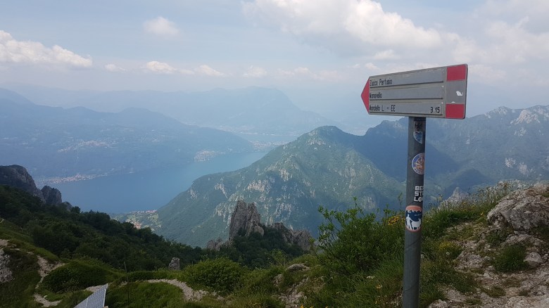
At some point, the trees disappear. This changes the character of the hike from something not very unusual to something special. Richly green grass wraps around the Dolomite stones, while steep below the blue of Lago di Como sparkles in the sun. At good sight, Milan sends a greeting from the plains and the mountains of Switzerland appear. Like many peaks at Lago di Como, the long views into the distance are amazing. Provided it’s not one of these humid days. Then, it’s still beautiful.
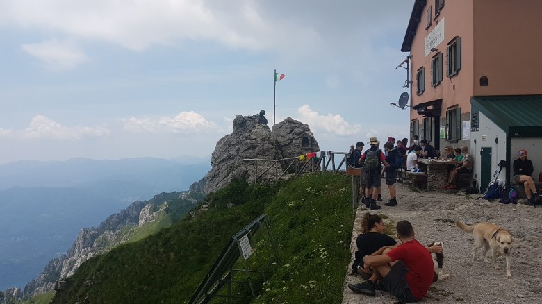
Up at the rifugio, climbers use the adjacent rock formations that lead up to the final peak of the mountain itself. Higher parts of that area are challenging terrain; people have died there. Apparently, it’s one of the more popular spots for climbing around Lago di Como. The rifugio has a good kitchen that offers lots of traditional Lombardian mountain food. It’s one of the better rifugi I’ve been to in Lombardy. Uncomparable is the excellent panorama from its location. In 2016, it has been around for 110 years. Partisans used it as a hide-away during World War II.
We took two hours to get up. That was about half an hour earlier than the signs had indicated. We walked rather fast, so two hours and a half seems like a good estimate for most.
Sunday: An easy bike ride around Lago d’Iseo
It’s not the first time that I recommend Lago d’Iseo. I just adore that fantastic bike path at the North of the Lake. The new 2km bike trail of Limone sul Garda got a lot of media attention this year (because it’s part of a bigger plan that I suspect might never materialize in full). At Lago d’Iseo, there’s an 8km trail of similar panoramic beauty and it’s not a dead-end like its cousin at Lago di Garda. I had wanted to take my friends here ever since I discovered it two years ago.
We rented mountainbikes at the camping of Iseo itself. The bikes are principally not bad, but they are also not too well maintained. I would not want to do steep single trails on it. We didn’t have to. It’s all fine for a flat loop around the lake. They are super cheap and the guy is friendly. They are also open on Sundays.
Our loop started clockwise. This way, we had the boring part around the Southern end of the lake at the beginning. There’s a lot of traffic. You can cycle away from it on a bike lane for most of the way. Once you pass Sarnico and a few camping sites in the Southwestern bay of the lake, the traffic disappears. A long tunnel leads through a rock. You get away without bike lights if you forgot them; there’s enough light in the tunnel.
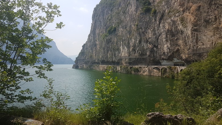
Coming out of the tunnel, the atmosphere of the lake changed markedly. You’re now in the Alps. Mountains are tall and at times bizarre. There are just two villages and another tunnel to pass and what follows is a road that is literally carved into the stone. Overhanging rocks accompany drivers and riders. After a third tunnel (short, but in a turn), the valley widens and the small village of Lovere found just enough space for a beautiful piazza. Get the best gelato at the lake right there.

Lovere is at the Northwestern end of the lake. The scenic route continues at the Northeastern end in Pisogne. Unfortunately, space to build a touristic and protected bike connection between the two places was never used. North like South, you need to cope with a little bit of traffic. Much of the road is wide and drivers are attentive, however.
A few kilometers after Pisogne, this 8km trail starts. It’s the Eastern counterpart to the one on the Western shore. The only difference is: they gave up the road and blocked it for car traffic. Cars go through a tunnel next to it. Then they took a brilliant decision and transformed the old road into a maintained and paved bike path.
South of it, the mountains are less close to the lake. That left space for a train line (runs hourly to the foot of Mortirolo and Passo Gavia) and for more people to move and enjoy living at the lake. Over time, settlements connected. Nonetheless it’s a pleasant ride, as mostly you still ride directly at the lake and actually you continue to make use of added bike lanes all the way to Iseo. In some of the villages, there are spots to take a bath. We picked the Perla Sebina beach between Sale Marasino and Sulzano.
The whole loop is flat except for two absolutely not steep hills that accumulate 20-30m of elevation each. The total kilometers sum up to 60. It’s a very easy route with lots of features of the big lakes. If the whole loop is too long, just go up the Eastern side and take the train back. As a cyclist, don’t miss it though. Presumably, you’ve never heard of Lago d’Iseo before. It’s the definition of a hidden gem. Christo’s floating piers art installation from 2016 hasn’t changed that. The lake fell back to sleep.
