
The first surprising outcome of my research for this article relates to the sheer number of hiking days that this year included. To date, I count 21. Considering the amount of time I’ve spent on the bike, this is quite a high number. Two reasons contribute to that: First, I hike also in winter. Second, I’ve had three, four hiking-focused weekends with special guests such as my Mum, the pancake, and my best friends.
I had conceptualized this post last Winter, but I’ve been smart enough to permanently forget to track the hikes both on the Garmin FR 935 and my phone. However, there is comparison data for four of my hikes. The most recent one I did with the phone (a Samsung Galaxy S7) running as well. On two hikes in Italy, a friend tracked with his own watch (a Garmin Fenix 3). Another friend joined me for a recent hike on the Bavarian side of the Alps and tracked it on a Garmin 735 XT.
I’ll focus on these four hikes. However, I’ll talk about noticeable things from the others as well. For instance, I’ve had a few hikes through narrow canyons. Usually, the tall rock walls compromise GPS reception. I can’t tell if the FR935 worked better than other devices under such conditions. I can still tell you if it worked well compared to the map or not. For all analyses, I use DC Rainmakers Analyzer tool.
Why should you care about accuracy if there’s no map anyways
No matter how good or bad the accuracy, the FR 935 has a big limitation as a hiking watch. There is no map. If you’ve ever been out in the woods (chances are high, given that you found this post), you’re aware that lots of alternative trails might fork off yours. At complicated intersections, seeing those trails on a map might facilitate your navigation. I’ve recently been at a point above Lago Garda where three trails veered off to the same direction next to each other. They run at different height levels and separated after 100 meters.
The Garmin FR 935 offers navigation like any other outdoor smartwatch from before 2018 and very likely like most outdoor smartwatches for some years to come: you get at most a screen that shows a blank map and the trail that you have to follow. Kind of like breadcrumbs. Maybe you get turn-by-turn instructions. (Even though at most 50 times thanks to some genius at Garmin who specified an outdoor smart watch for short activities only.) There’s no map, but you get to see the direction that you should follow.
Here you stand again at that crossing with three paths going into the same direction. With the breadcrumb navigation that the FR 935 offers, you’ll pick one and walk. You’ll soon notice if you picked the right one. If you didn’t, you’ll return and try again. I used the outdoor mapping app on my phone (OruxMaps powering OpenAndroMaps) to pick the right one straight away.
So what’s the point of this post if the watch itself doesn’t offer a map? In other words: why should you care about GPS accuracy of this watch during a hike?
Here’s why you should not care: (1) It won’t dramatically affect your hike stats. Hiking, unlike cycling, is a slow activity. You might spend hours hiking to accumulate only 10 to 20 kilometers anyways. Maybe you’ll end up hiking 13.2 instead of 12.9 kilometers due to GPS inaccuracy. (2) Strava KOMs on hiking segments exist, but they are silly. A few weeks ago, I got second on two segments during a fast solo hike. I even bragged about that to the pancake. It’s one of the silliest things I’ve ever done. There’s no point I’d be pissed if Strava wouldn’t count me on a segment because of bad GPS data.
And finally, this is why I care.
I track my hikes for three reasons. First, I want to account for the exercise when I calculate my total effort load over a week. Second, it’s a nice memory. I do occasionally open old activities on Strava just to look at them again. Third, I share hike files with friends that happen to go into the same area. I could simply share the track which I followed. More often than not, I deviate from that track for interesting reasons. It’s easier just to share the activity that I tracked rather than to share the track that I followed and explain where I did deviate. (By sharing the activity, immediately they also have some hint as to how long the hike will take them.) It’s that third point for which I care about GPS accuracy. I don’t want to share crappy data with them.
GPS Accuracy compared: Four hikes with the Garmin FR 935
Quick note at the beginning: On the watch, I’ve activated the GLONASS option for all these hikes. I had noted mediocre GPS accuracy of the FR 935 during cross-country skiing activities. These tests took place when I only used GPS, no GLONASS. I did notice the difference already during bike rides. In the upcoming winter, I’ll might revisit the GPS performance in cross-country skiing.
Hike 1: San Fruttuoso to Portofino, Liguria, Italy – Garmin FR 935 vs. Garmin Fenix 3
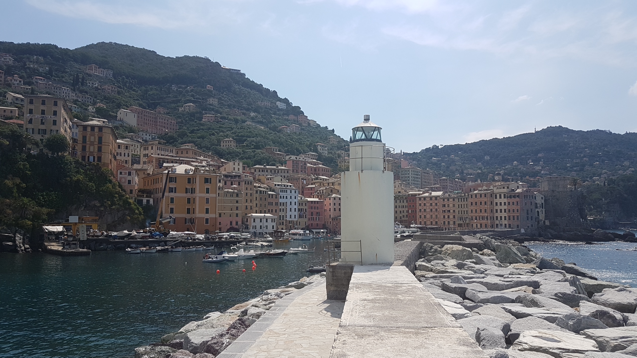
Camogli is Cinqueterre minus mass tourism 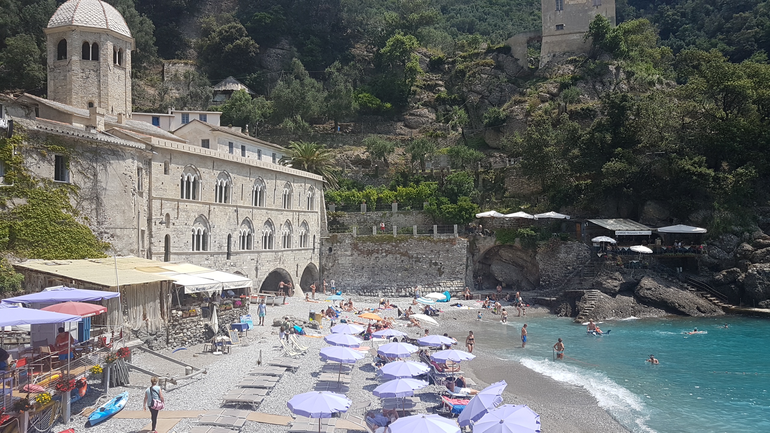
San Fruttuoso has the flair of a pirate retreat
I highly recommend the hike itself. We took the boat from Camogli to the isolated abbey of San Fruttuoso. From there, it’s two-and-a-half hours to Portofino. Another boat trip (or bus trip) to Santa Margarita Ligure, then a five-minute train ride back to Camogli. The whole round trip takes at least four hours, but give yourself time to enjoy all the places and make it six or even seven. Camogli and San Fruttuoso aren’t as crowded as Cinqueterre, but offer virtually the same atmosphere.
Here’s an overview of the hike. And this is a direct link to the files.
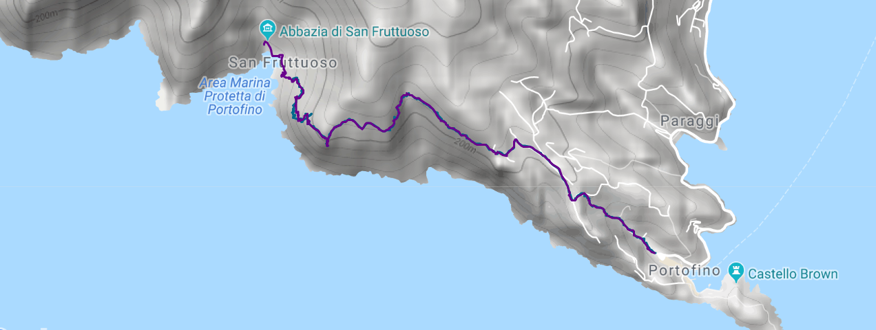
Immediately, I notice that both watches track very similar. Nearly identical in fact. There’s only one part of the trail in which they disagreed. Let’s take a closer look at it. I’m switching to a satellite view in an attempt to see which track follows the trail closer. Due to the forest, it’s impossible to tell. We can tell, however, that one of the watches had big problems. As a matter of fact, it’s the FR 935.
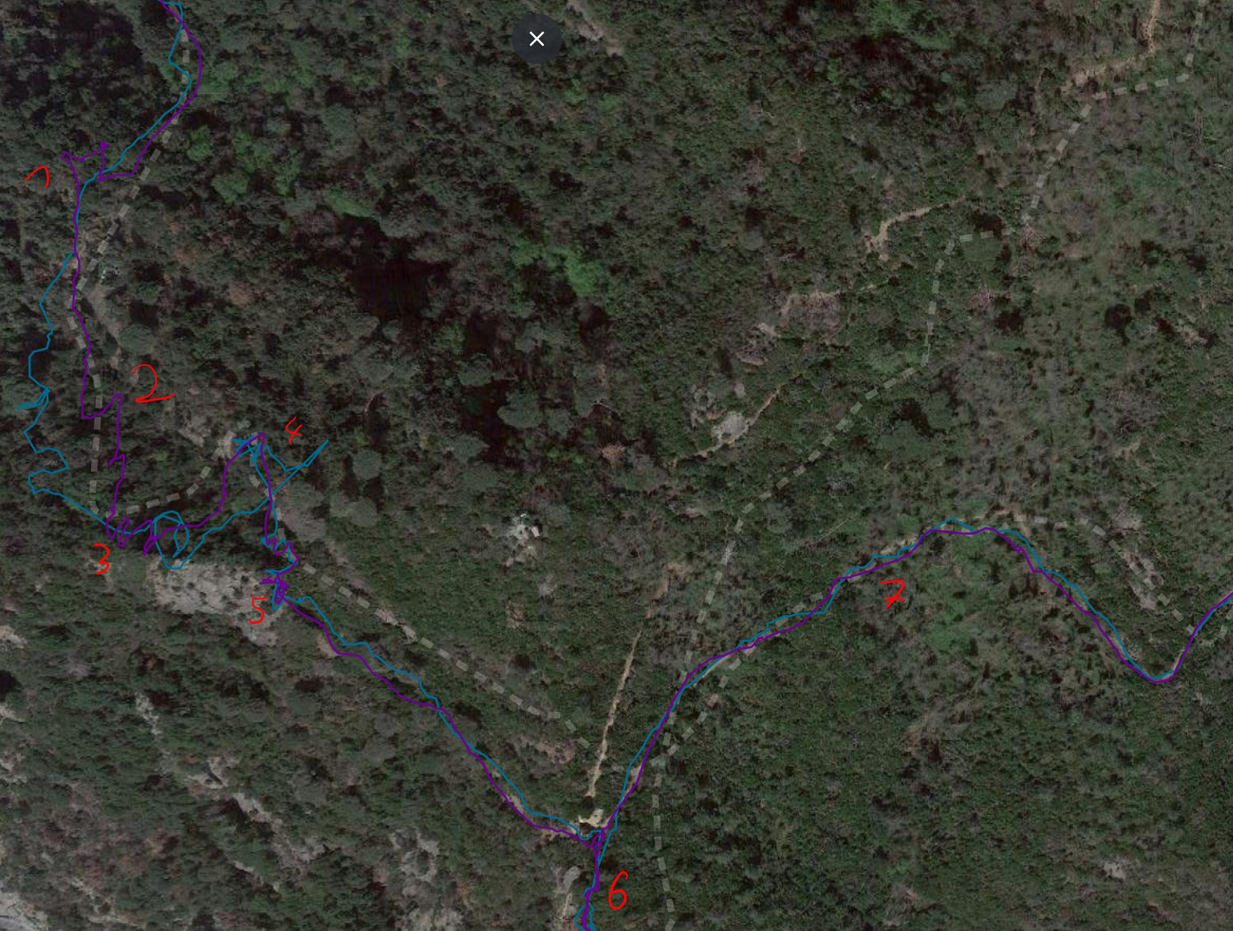
I’ve highlighted a few points. The first disagreement at point (1), that’s most certainly a mistake on the side of the Fenix 3 We had stopped briefly and I had stopped the record. At point (2), the Garmin FR 935 is far off the track. You recognize sort of the same turns as in the actual track, but you also need to add substantial drifting. The switchbacks at point (3) existed indeed. Only the Fenix 3 recognizes them. The FR 935 just dances around. The fascinating movement of the FR 935 between point (3) and point (4) is nonsense. At point (5), we had taken another rest and I didn’t stop the record immediately. In this situation, the Fenix 3 started to think it’s moving around.
Put short: that’s bad. It was a sunny day. We were hiking up through a forest, but the FR 935 is a newer-generation watch as compared with the Fenix 3. I checked twice if I mixed up the watches. I didn’t.
I can tolerate it if that’s the exception. Every watch can have a day off. And indeed, things then get very similar as we leave the forest and they don’t turn bad again when we return into it. At point (6), the Fenix 3 is absolutely spot on, while the Garmin FR 935 still does a great job in showing the same path back and forth. Point (7) shows that the track of the Fenix 3 looks much more smoothed as compared to the track of the FR 935. Depending on your perspective, this is a feature or a weakness. Differences are tiny here anyways.
One more remark: that day, the watch took a very long time to initialize the GPS connection. I waited almost five minutes. Generally, I find the FR 935 to take longer than my phone. I waited till the status went from yellow to green. Still, I’m wondering if I better then had re-started initializing. Maybe the added time would have prevented the problems that I observed. In any case, I wouldn’t like that. It’s wasted time.
Hike 2: Rifugio Rosalba from Piano Resinello, Lecco – Garmin FR 935 vs. Garmin Fenix 3
The Alps at Lecco are Dolomites at lake level 
Views are frequently a bit misty in Spring and Summer
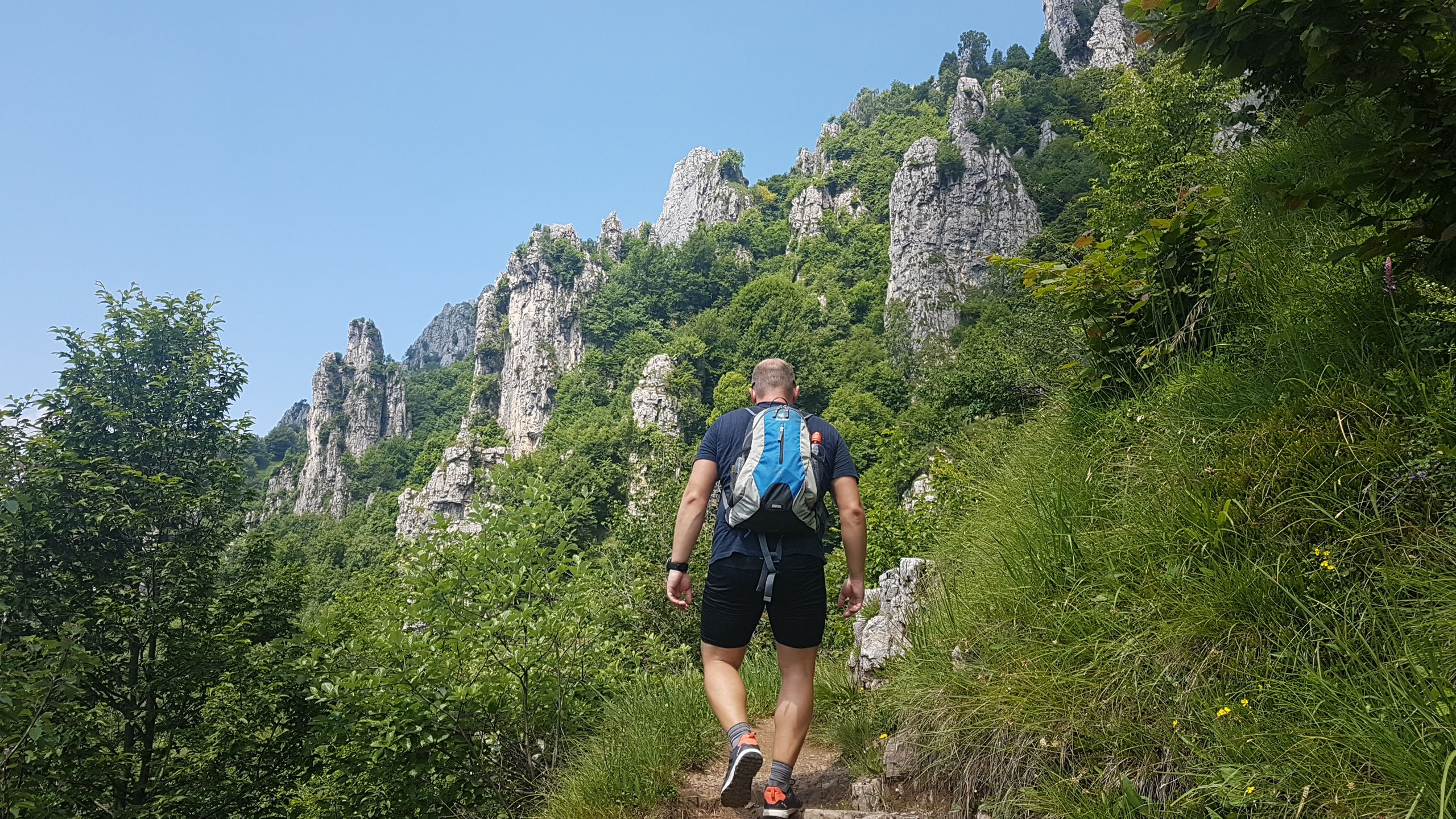
Lecco is Como’s unknown sibling at the Southeastern tip of Lago di Como. It’s the nicer part of the lake for hiking, I find. The rock formations are basically identical to the Dolomites. The only difference is the lack in altitude; the vegetation differs for that reason. This particular hike is physically challenging and includes some very steep steps over rock. Two times, I needed my hands. Going up, I was worried about feeling scared when going down. When we were actually going down, things felt easy.
Oh, and here’s again the link to the files.
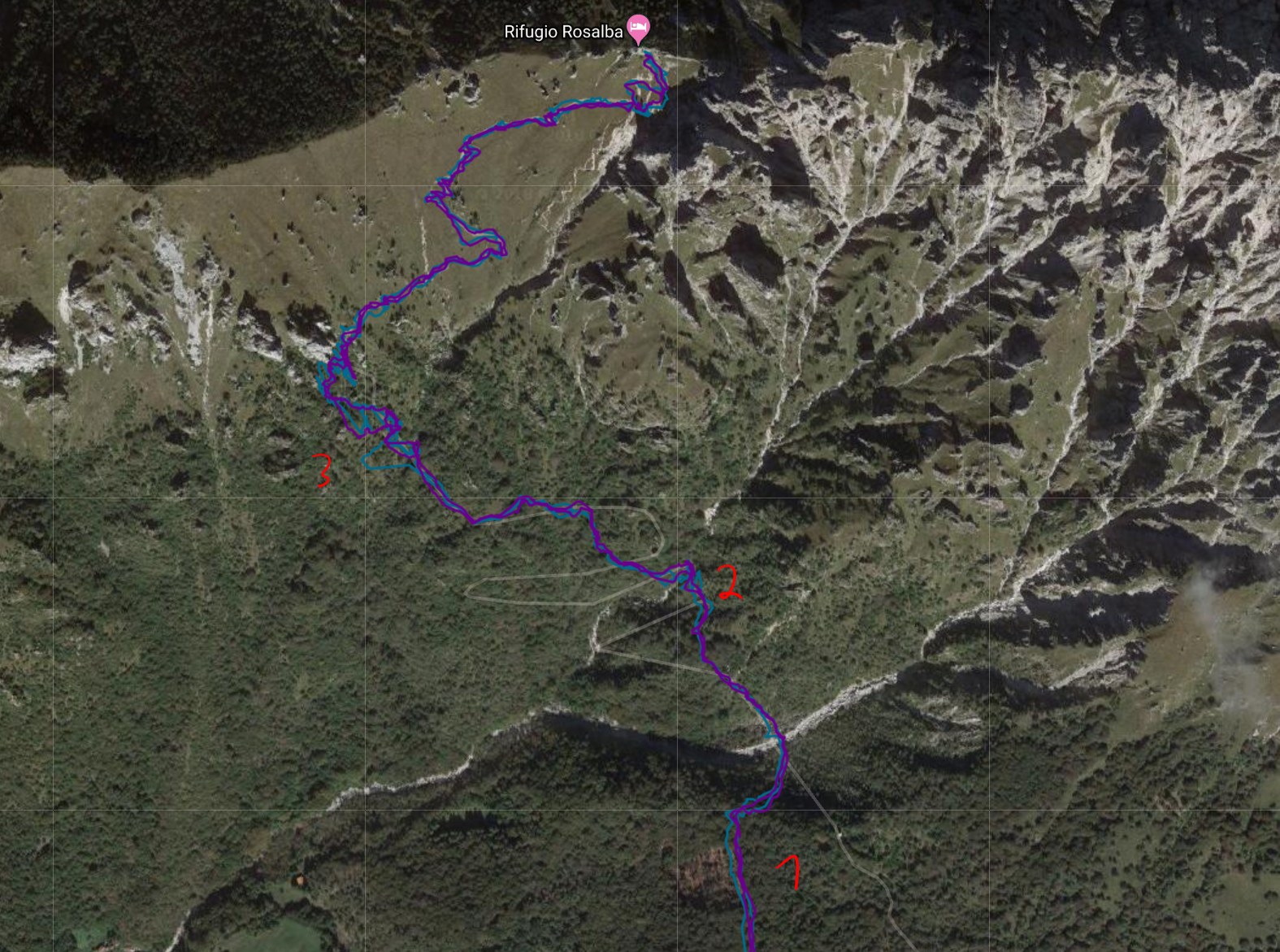
Most of the track looks as neat as the section next to point (1). If you look at it closely, the FR 935 (now purple) performs marginally better (way up and way down are more often parallel to each other). There are some deviations between way up and way down in the area without trees (in the upper part of the picture). That’s correct. The path split up a few times.
At point (2), there’s a bit of a knot in the blue. That’s actually not much different from other points in the track. Generally, a bit more smoothing on the FR 935 makes this appear more accurate. In truth, both are doing good. At point (3), both are doing bad, but the Fenix 3 does worse. In that section, we did not follow different paths going up and down. The track suggests we did and that they were about 20m apart from each other. This was the steepest section of the entire trail, so our moving speed also was slowest.
Hike 3: A crowded hike at Tegernsee – Garmin FR 935 vs. Garmin 735 XT
Tegernsee is popular for group hikes 
The farther away from the lake, the lesser the crowds
This was a hike at the end of a very warm October. We had originally planned to go mountain-biking, but then I forgot my helmet and anyways we concluded it was too wet for that. We went on a hike instead. We were not the only ones. Dozens of people shared the idea with us. Things got quiet when we extended the hike from the first peak to the next, as that was a little bit less on top of the mind of others. That said, it’s a beautiful hike. It took us about three hours. With more relaxed pace (we were quite running up the mountain), it might take you four-and-a-half.
Not forgetting the link to the files, if you want to have a closer look or download them to repeat the hike.

The data itself is beautiful, too. Points (1) and (2) mark the single worst bits on the entire track. If I look closely, both watches are slightly off on the way back at point (1) – and also further down towards the top-left. At point (1) and point (2), the FR 935 appears more wonky than its predecessor. Since this is such a short bit of route, I don’t dare to really take any fundamental conclusion from this. Superficially, you could argue: if there’s a lack of accuracy, it tends to be on the side of the FR 935.
Generally speaking: Both agree very much and both show accurate locations with respect to the actual trail.
Hike 4: First sun, then fog – Garmin FR 935 vs. Samsung Galaxy S7

Hiking in fall brings moody light, but huts are closed 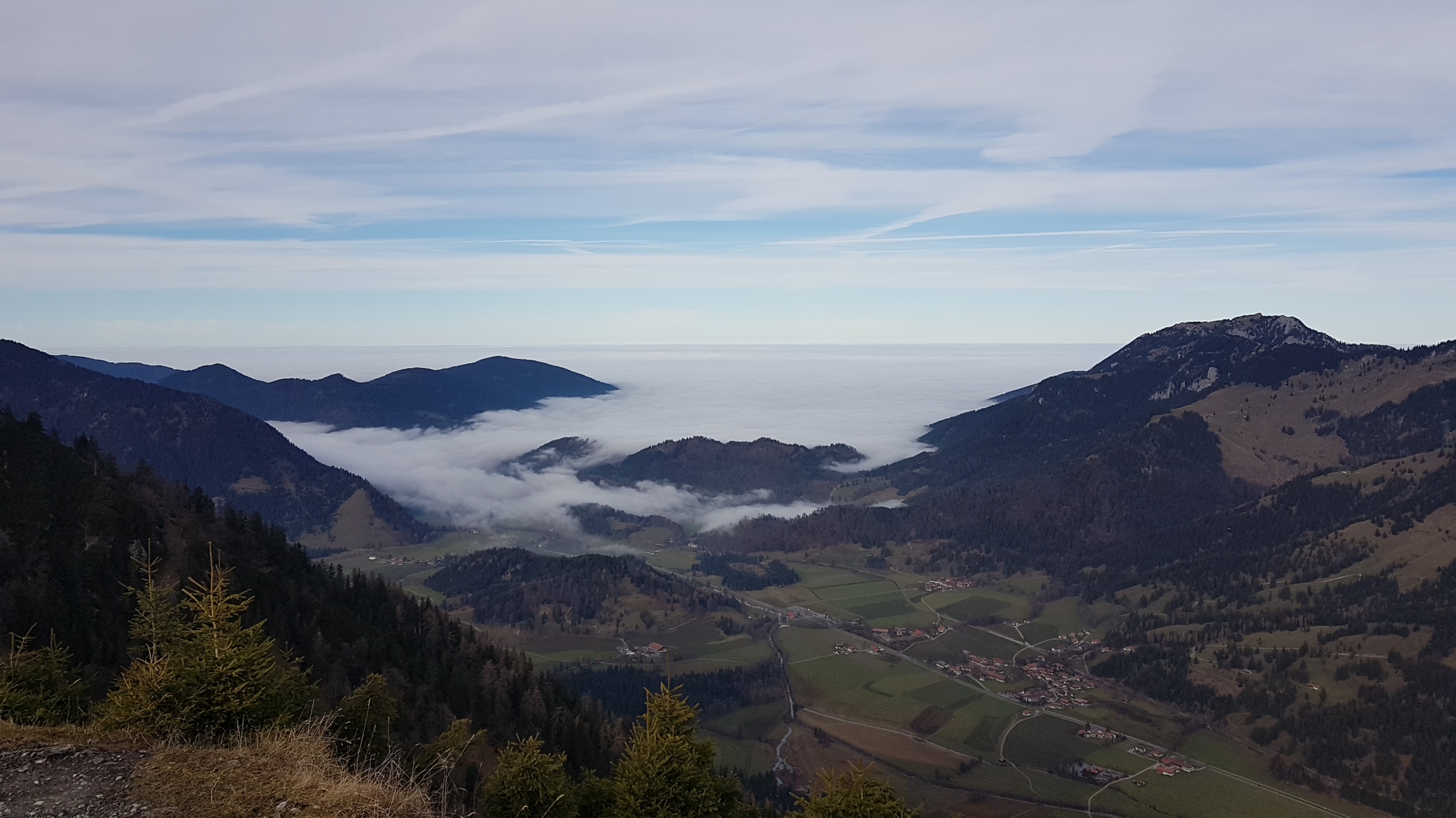
In Bavaria, fog from the flats creeps into the valleys
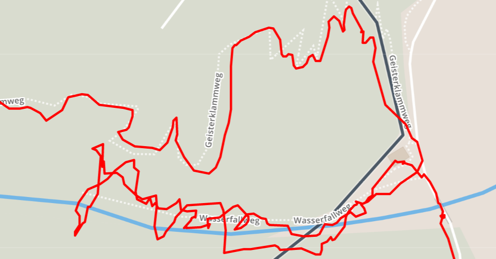
This hike starts at Bayrischzell. It’s the last town you can reach by train. (You can also start in Geitau, walk in opposite direction, and don’t close the loop.) Directly from the parking for the Seeberg trail, the hike starts to climb. It’s not too steep, but keeps on climbing for the next five kilometers. However, with a clear sky, the views are awesome. For me, they extended to the already snow-covered peaks Southeast of the Inn valley in Austria. To the other side, I saw fog creeping into the valley at which I started. And indeed: when I reached the valley again, fog had covered all of it. It was a near-mystic change of scenery and atmosphere.
This comparison (here’s your link to the files) differs from the others in that it’s not putting two Garmin products head-to-head. Instead, I tracked the hike both on the watch and on my Samsung Galaxy S7. The tracking app which I used is OruxMaps. In cycling, I’ve made so-so experiences with the Samsung. The app rocked on my previous phone, a Sony Xperia Z3 Compact.

I didn’t show the elevation graph for the other hikes because differences in altitude were lower than 10 meters. Here, the difference sits around 100-150m. Both devices follow the same pattern; the difference remains basically the same over the course of the hike (it’s a bit narrower on the long downhill). The correct starting altitude would have been 796m. The FR 935 gets it completely wrong. I then re-examined the elevation for all other 20 hikes that I did in 2018. This is the only hike with a significant altitude difference. In other cases, differences never exceeded 10-20m. There were two other hikes where the watch showed 50 and 70m too high altitude.

The general overview makes another argument that a smartphone can perform absolutely on par with a dedicated smartwatch for sports. The value of the watch for the hiker then is heart-rate tracking and in the longer battery life. (See below.) There are really just few points where the smartphone deviates from the watch by as much as 5-7 meters. That doesn’t really matter in reality. Noteworthy: From about where I reached point (3), I was hiking through the fog.
With the next image, I zoom in on point (1). I highlight this section because it was the most challenging part of the hike: I was climbing up through the forest over a number of narrow switchbacks.
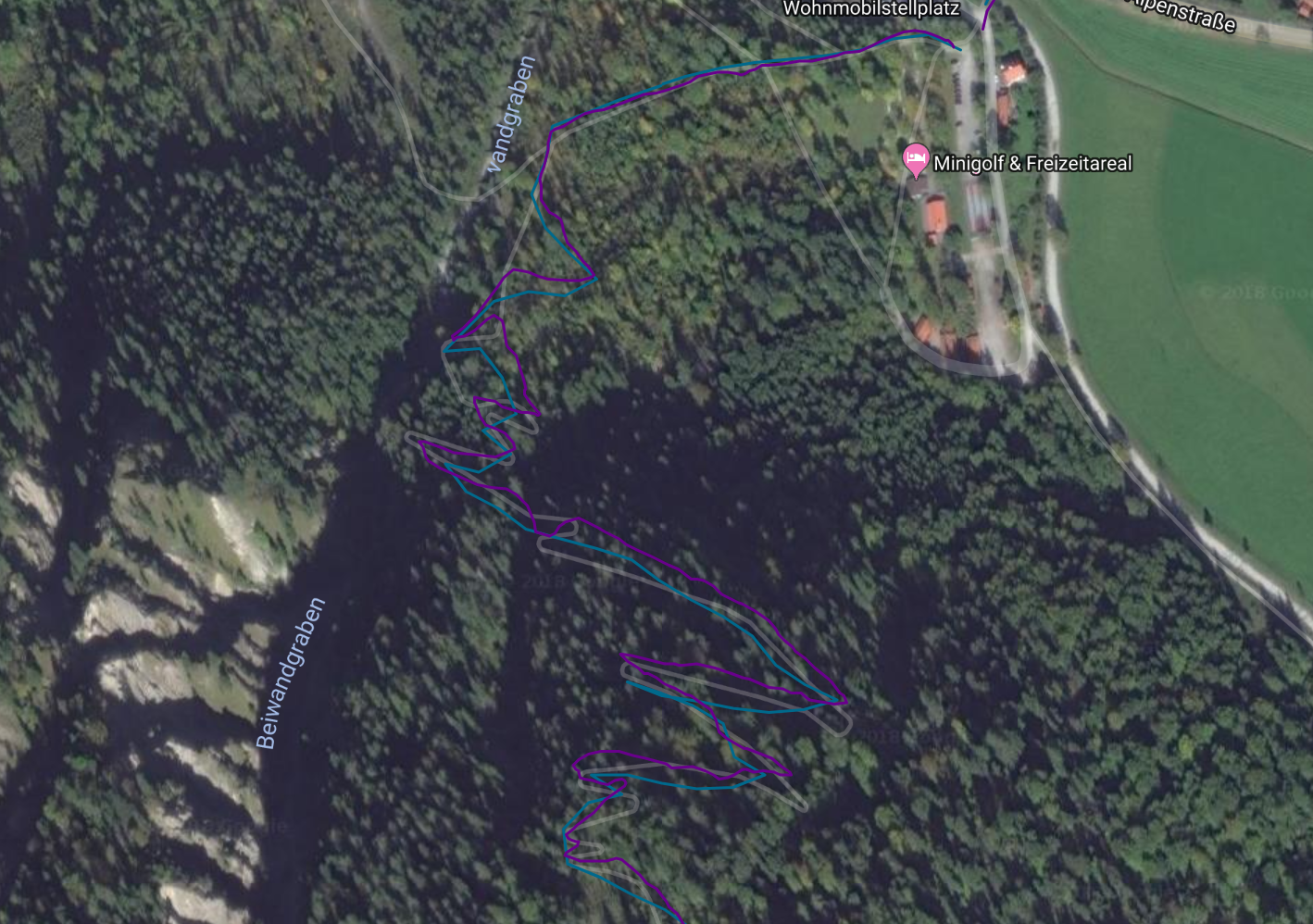
In this section, both get it rather correct, but both disagree. The Maps labels indicate the actual trail, but I don’t trust those either. However, the track of the Samsung Galaxy S7 appears more edgy, as if it tracks slightly fewer points and therefor doesn’t get the switchbacks quite right. This is consistent with what I’ve seen in fast switchbacks going down a mountain on a bike. Differences are small in any case: around 5m between both watches in this section. For hiking, that’s absolutely good enough.
One word on battery life: In total, I spent 4 hours hiking. As I arrived by car, my phone was fully charged when I departed, as was the FR 935. The battery of the watch consumed about 20-25%, while the phone went from 100% to 61%. Note that I had mobile network switched off for all but the last 20min of the hike. I only had the screen on when I needed to look at the map or wanted to take pictures, i.e. about 30min screen-on time in total.
Heart-rate: It might be accurate
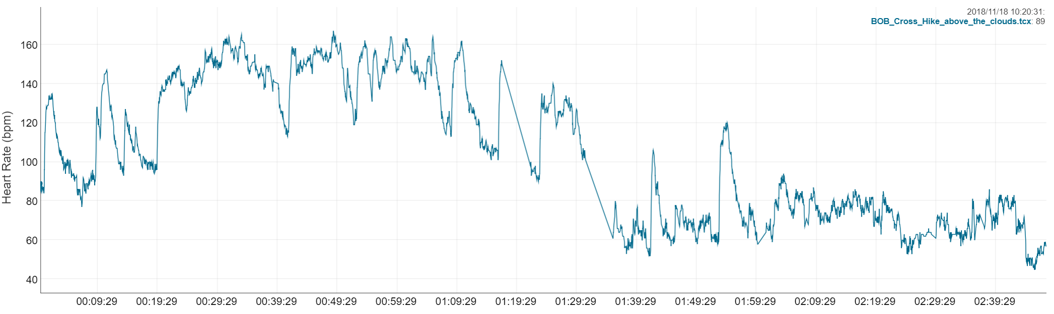
I don’t have a head-to-head test of the watch vs. a heart-rate strap for the same person on the same hike. When we hiked with two watches, two different people wore them. On the Seeberg hike, I had wanted to test it heart-rate accuracy alongside GPS accuracy. I forgot to turn on the ANT+ connection on my phone to pick up heart rate from the heart-rate strap. Instead, the watch picked up the heart-rate strap. However, here’s the heart-rate graph from the San Fruttuoso hike.
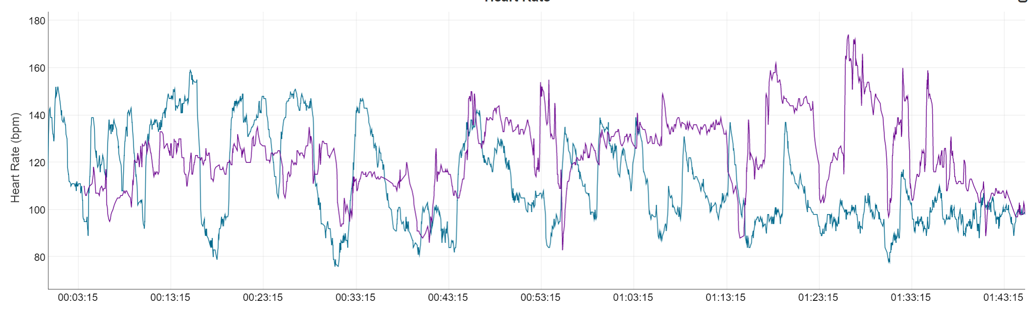
Note that the first 35 minutes featured a climb from sea level to 250m higher. On the last 30min, we descended into Portofino. The graph of the Fenix 3 suggests exactly the inverse of that elevation profile. The heart rate stays at zone 2 levels (resting) and moves into effort levels on the way down. That doesn’t make much sense. On the side of the FR 935, the pattern is more consistent with the perceived effort. However, there are some ups and downs in the heart-rate. I’m not confident enough to declare all of them correct. Some are. The longish rest periods around minute 20 and minute 30 match two short breaks in which we waited for one of us to catch up. (That one of us wore the Fenix 3, so it makes sense his heart rate stays constant in these breaks.)
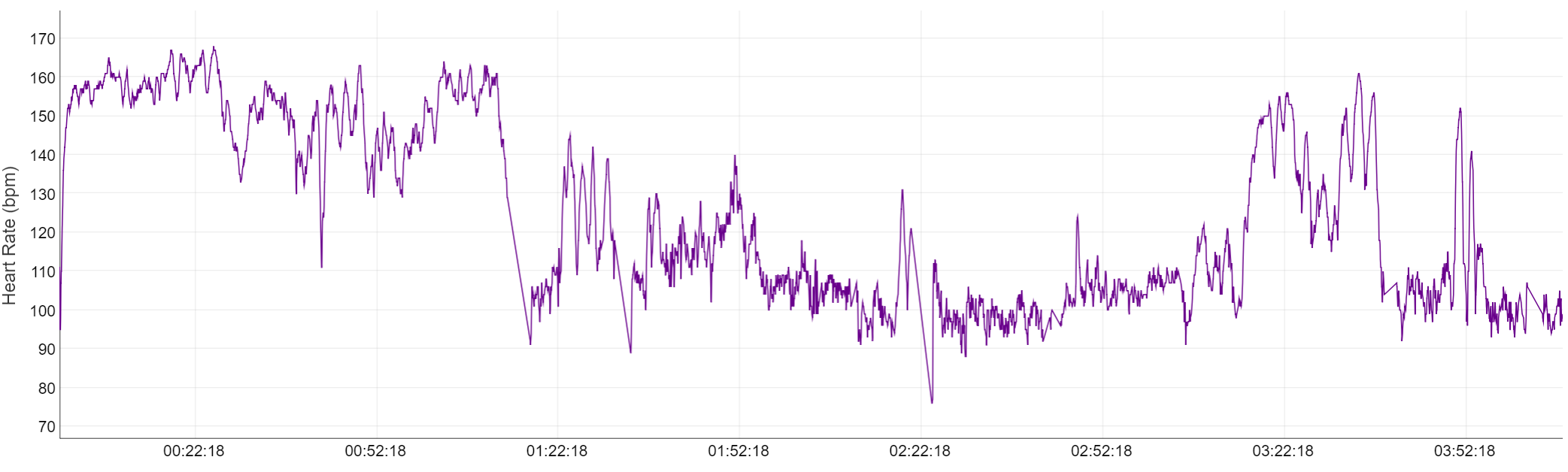
A word of warning: this section is data-based speculation rather than testing. Below you have a graph from the Seeberg hike. This is heart-rate data from my Wahoo Tickr. It took me six minutes more than one hour to reach the summit. The slope was similar to that in Italy, just longer. I hiked at higher speed, but at lower temperatures. (It was around 35°C in San Fruttuoso.) I didn’t take any micro-break on the way up. The graph shows fewer spikes on that long uphill. This might be due to the more consistently paced effort. There are spikes later where it was more of a stop-and-go due to navigating and taking pictures. This is a pattern that I should also see in a similar hike with the FR 935: The second panel below shows a hike from one week before the Seeberg. I crossed from Schliersee to Tegernsee and I started with a very similar (just steeper) climb. The climb starts 20min into the hike. As on the Tickr X, I now see many less spikes. So that’s good. However, I observe that my heart-rate runs around 5-10 beats per minute (bpm) lower than one week later at a similar uphill effort. Similarly, the FR 935 suggests that my heart-rate meandered between 60 and 80 bpm when walking in the flat or even down-hill. In similar terrain, the Tickr-X has me at 90-110 bpm, which I generally find more reasonable. (My rest heart-rate is at around 48-55, depending on what I did the day before.)
Generally, the heart-rate graphs of the FR 935 are consistent with the activity. With lots of hair on my arm, admittedly I have a tricky arm for optical heart-rate measurement. This needs more testing. However, based on what I have in front of me, I’d say it’s not too far off. That’s different as compared with what I saw last Winter during cross-country skiing. Back then, the watch missed the beat by 30-40 bpm. And here’s the thing: In hiking, I measure my heart-rate to keep track of my cumulative training stress. Hiking is rarely a controlled interval training activity. Therefore, consistent differences of around 10bpm matter less as long as they are mostly consistent and not fundamentally larger than that.
Summary: Yeah, it’s accurate. Mostly.
I had mentioned other hikes which led through canyons. I’ve had a careful look at them: the watch did great. There’s one exception to that: The Leutaschklamm, at most 5m wide, something like 50-70m deep, caused some wonky GPS records. But honestly: you would expect that. It’s almost like walking through a tunnel.
Aside of that, neither cities, nor trees, nor fog, nor any combination of these factors caused big problems for the FR 935. I might find tiny bits of the track where the watch would be 5-10m off. (For instance, the switchbacks on top of the last image.) There’s not really a reason to make this an argument for inferior GPS accuracy. Really, the wobbles that I observed in San Fruttuoso were an exception from the norm that I see in regular use. At the beginning I made the point that accuracy in hiking really matters most when you want to follow a previously recorded track. I’d trust the FR 935 on that.
That said, cheaper, older watches are not worse by any means. The 735 XT was as spot on as its successor if not a tiny bit better. The Fenix 3 did not draw an ugly track where the FR 935 did. The Samsung Galaxy S7 was absolutely competitive on a multi-hour hike that included steep terrain, forest, and fog. The advantage of the FR 935 over the phone is in its inbuilt heart-rate tracking feature with no need to wear another sensor. To that end, the watch delivers consistent measures – read this without a final verdict on the accuracy of the FR 935.
Next up: back to cycling. I got the Halycon upgrade for my Stac Zero trainer and currently organize my observations for a usability-focused review.
