
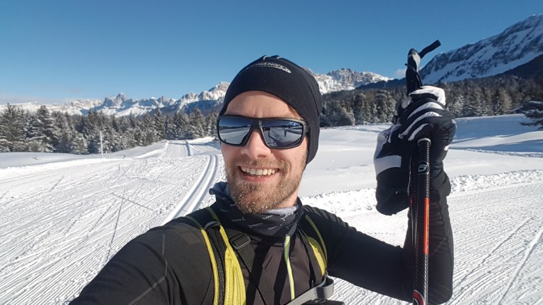
The other day, I wrote about my cross-country skiing experience in Deutschnofen. However, I had more than one day. Five in total. Each day I explored another area in the vicinity of Bozen. To that end, Bozen is a fantastic location. All of the places I reached within 30 minutes and one hour, even though they were quite spread. For the future, other areas in Trentino and South Tyrol are in reach as well.
I was doing everything on classic ski, but skating was available everywhere as an alternative. Every day, I did between 20 and 35km. One day I only managed 15km. That day, I left later: It had rained in Bozen in the morning, and snowed in the mountains, and the car I had only was equipped with summer tires and snow chains. (Italian car rental companies…) Buses are a feasible and frequent option. In South Tyrol, schedules are not available via Google Maps. Moovit is a general public transport app which includes them. Otherwise, there’s the website of SAD, which is the local transport company. Unfortunately, there’s no English version of that website. You need to speak German or Italian.
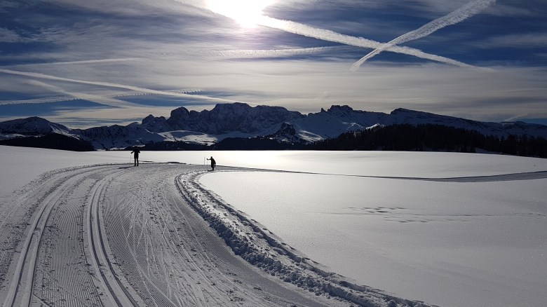
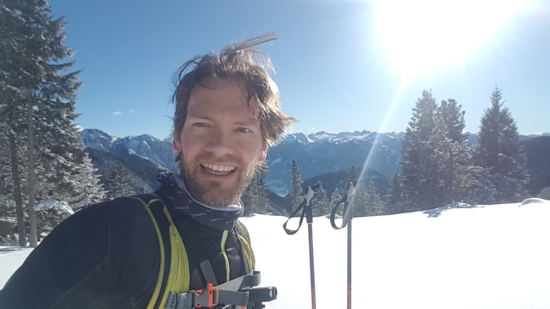
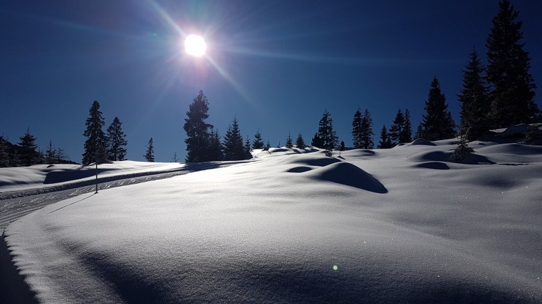
If you have the chance, I highly recommend a winter experience in South Tyrol. The views were breathtaking, and snow was abundant. (In Bozen itself not so much. It’s 1000 to 1500 meters lower and usually too warm for snow.) During my day at Alpe di Siusi, I took some clips and edited them in a short video, just to give you some impression of the panorama that I looked at.
For the remainder of this post, I will quickly go over four of the five areas that I visited. I will not repeat what I said on Deutschnofen/Nova Ponente. You can look it up here.
Marcialonga/Lago di Tesero
On my second day, snow was announced for areas North of Bozen, but the South had a better forecast. The day started out cloudy, but it got sunny in the early afternoon. On the way back, I could still see the bad weather in the North. The contrast was sharp and it had played out in my favor. In the mountains, small distances can make big differences.
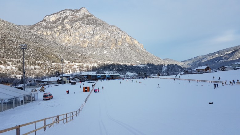
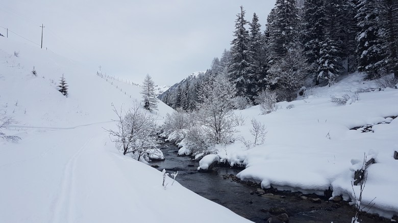
I started in Molina di Fiemme. There’s a parking South of the river at the beginning of the street to Passo Manghen. The track starts here. Or: ends. Molina di Fiemme is the lowest point of the Marcialonga. The Marcialonga is a marathon for cross-country skiers. The long distance covers 70km and goes through the entire Val di Fassa and Val di Fiemme. The short distance covers only 30km in Val di Fiemme. I’m impressed by the times that participants of this ski marathon do. If I gave it all, I might manage just not to be last. I’m not that bad in cycling. In cross-country skiing, I am.
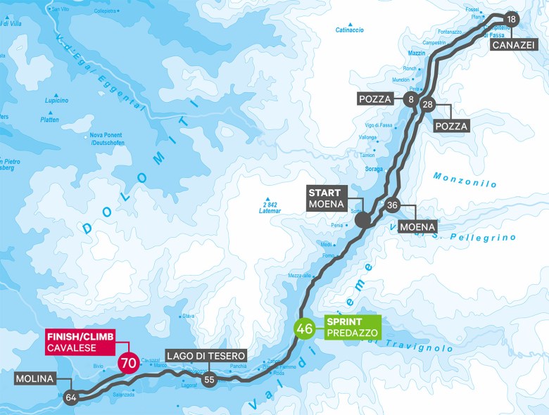
The Marcialonga is an easy route. The track runs up the valley next to the small river that winds through it. While it’s always going up, the incline is very modest. In Summer, it’s a family-friendly bike path. From Molina di Fiemme, it’s 8km to the Lago di Tesoro arena. That’s where the valley’s cross-country World Cup takes place. (The Tour de Ski traditionally ends in this arena.) The tracks for the pros are sometimes prepared as well. Then, it’s another 8km to Predazzo. Those are a tiny bit more challenging at first, then not. At Predazzo, turned around. The way back followed the exact same route. I personally don’t like that very much. I prefer meaningful loops. That’s not easy in a valley with some population and other infrastructure.
I was really happy with the preparation of the tracks. Furthermore, each kilometer a sign informed me about the remaining kilometers to the next big destination (Molina di Fiemme, Lago di Tesoro, or Predazzo). This gives some orientation. Note that the track is on payment, but it really is pay what you want. There was no payment control on the track, but I passed (and used) something that looked like the ticket machine of a parking lot. It even had a blue P on the side. The fee would also be included in Trentino’s SuperNordicSkipass.
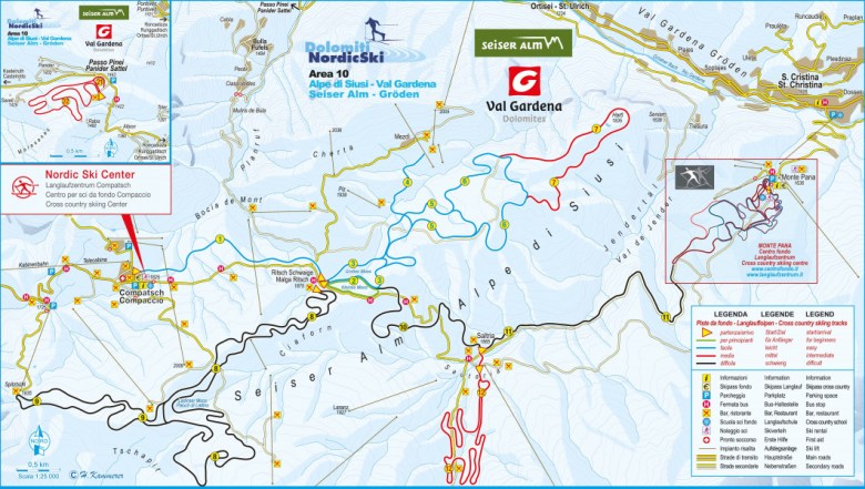
Alpe di Siusi/Seiseralm
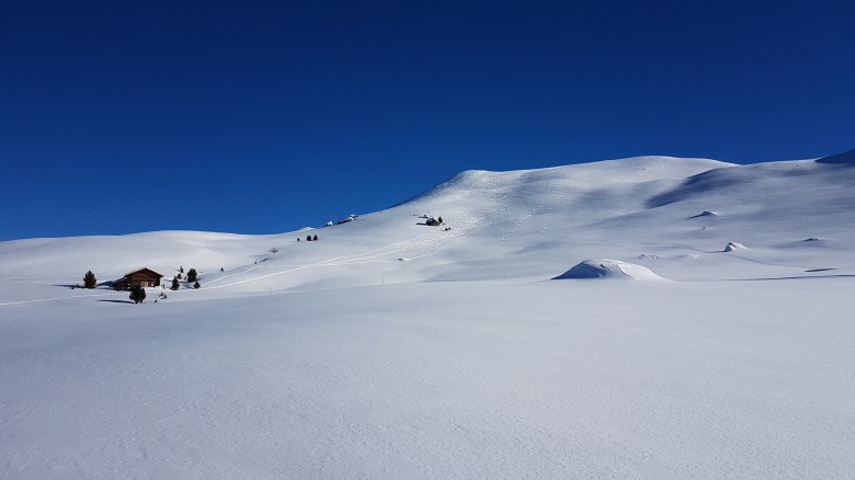
The Alpe di Siusi is a massive plateau in about 1800m elevation. There are tons of people, but so much space that it never feels crowded. Cross-country skiers share the area with snow hikers, freestylers, lugers (there are more than 10 tracks for luging), and alpine skiers. All of them have to go up via the same cable car, which connects Seis with the Alpe di Siusi. Arrive early if you want to make sure to find parking in the high season. Buses from Bozen go every 30min, however, and are only 10min slower than a private car.
Parking is free (there is also a paid garage, if you prefer to put the car inside a building with a roof, but without walls), but the cable car costs 17,- EUR for a return trip. A day ticket for the track costs another 6,- EUR. There are bundles for 3 and 7 days which help to save a bit on these expenses. At Alpe di Siusi, a guy checks and sells tickets at a central hub that every track will reach.
There are few trees up at the Alpe di Siusi. With wind or bad weather, you’re certainly exposed to the elements. Given its high altitude, that would also include bitter cold. However, on sunny days the Alpe di Siusi can feel even warmer than Bozen in the valley. In fact, I was lucky enough to catch such perfect weather. It was so warm that for some time I was comfortable skiing with an undershirt only; no gloves, no hat anymore. Another by-effect of the clear area is the 360° panorama, which beats the one that I experienced at Deutschnofen by a wide margin. I was literally flabbergasted when I saw it first.
Cross-country skiing at Alpe di Siusi starts from a central hub. Well, it starts from the top of the cable car, and then it’s a slightly hilly 2.5km connection to the central hub. In theory, there’s also a shuttle bus (day tickets cost 4,- EUR and are included in the bundles), but I couldn’t find the stop at the cable car.
To the South of the central hub, there are two long and challenging tracks. Though it’s actually one track with an extra loop of 3km, and it’s not as challenging as I thought it would be. It starts with a long and rather steep ascent, something like 1km. (Therefore, it ends with a similar descent. The snow was fresh and soft and therefore it was easy to control. I could just go down in the classic track and didn’t even need to break.) Then, the track still winds up, but not very noticeable and in front of the vast panorama. This track offers the best views for cross-country skiers. You cross downhill tracks a few times. At some point, you get into remote areas of the Alpe di Siusi, where at most snow hiking and ski touring might take place, and maybe not even that.
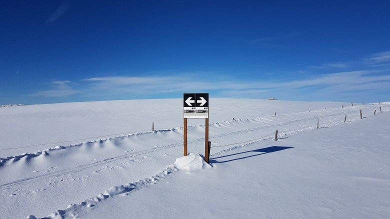
The track winds up literally: there were several bits of the course where it just made a 100m extra loop for the sake of adding distance, and I would return in the opposite direction just 50m away from where I was a minute before. While I prefer loops over tracks where way and return are the same, I found this useless back and forth very annoying for two reasons: First, there was no way to use these switchbacks for shortcuts to make this area also accessible for less endurance oriented skiers. Second, there was basically no signage which would give me some indication as to how much was still missing. Only at the beginning and at the spot where the extra loop would split off, I found a sign.
North of the hub, there are a few easy and a medium-level track. Or actually it’s one long track with several short cuts. This is a trick that many cross-country areas use to beef up their total sum of kilometers. (Some also double it if there is a classic and a skating track parallel to each other.) It’s deceiving, obviously. But anyways. They are between 2km and 12km. I did the medium-level full loop, which turned out to be more challenging than the track that I had found South of the central hub. There was a long descent as well, and it had a narrow turn, and it was followed by a climb that I definitely don’t want to return to. Maybe I was just tired, but I didn’t expect it.
At some point, this track enters a forest, and generally the views are not as great as they are in other parts of the Alpe di Siusi. Once you leave the forest, the central hub is just a kilometer ahead of you. Or so you think. Instead, you do a bit more of strange back and forth on basically the same spot. This time, at least, I found (and ignored) one shortcut.
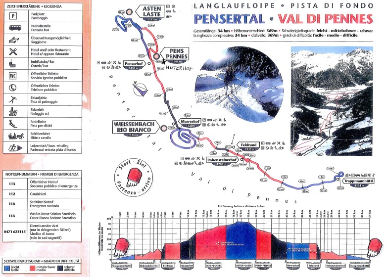
Sarntal
I can keep this one short: There’s basically one track through the valley that sums up to about 20km. In the central part, way and return share the same path. At either end and in the middle, there are short loops. Old maps indicate that on the Southern end the track continues for another few kilometers, but I did not find any information on this on the website of the area. Because I left out the Southern loop (it was slowly getting dark), I could not verify. In theory, there’s payment, and in practice, I didn’t know where to pay.
The area is remote. The Sarn valley is a spot in Südtirol that has been largely ignored by mass tourism. Very likely, that’s because you’ll always reach another spot before you’d get here. On the upside, you’ll get a very special, quiet and natural experience. The villages are tiny, and no lifts disturb the landscape.
I went here after fresh snow had fallen in the morning. At parts, I was the first one on that day to ski. The website states that they prepare the track every day, but I assume they do it every day in the morning or evening. In that case, I could still recognize the track, but had to re-do it myself. Initially, that was rather exhausting, because the snow wanted to glue to my ski and didn’t allow for gliding. It got a bit better as I continued on the track, because I also gained in altitude.
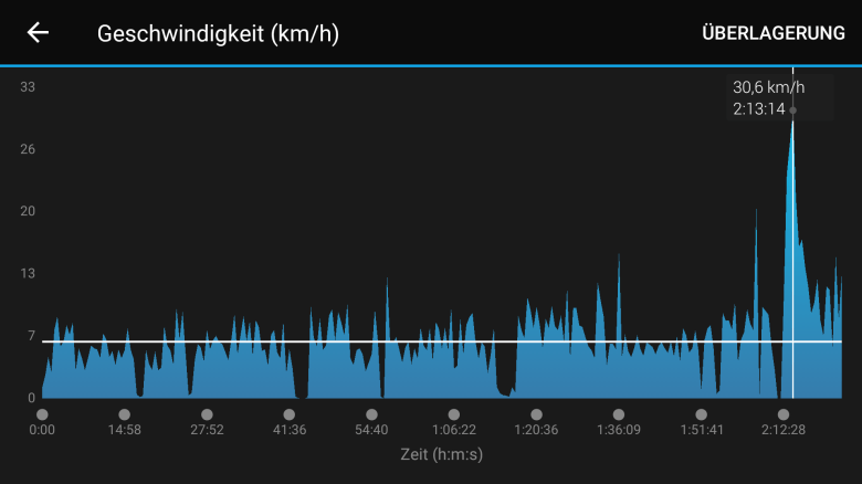
Signs were missing here as well. At some point, I was not sure if I should follow the left or right option. It didn’t really matter, for they were running in parallel, but I shouldn’t be left with guessing. Since the central part of the track is maybe not for beginners (what goes up in one direction, goes down in the other), some signs would have helped to warn them of a steep descent. In my case, I kind of had to push myself down to make at least some speed; take that spot with icy conditions and you’re easily getting up to 30-40km/h. Actually, I did make 30km/h at one point.
In each of the villages, it would have been easy to grab a bite. Easier actually than at Alpe di Siusi, where the restaurants are better located for Alpine skiers. I recommend to start at the lower end of the track and go up first, much like I did. Going up, you also don’t really notice how much of climbing it actually is. But it is a bit. This is the old map, by the way. I did the upper part, starting from Weißenbach and going to Asten. I did not do the blue circle at Weißenbach, but it should exist. The rest of the track to Feldrand and Trappmannhüttl is not listed on their very own website.
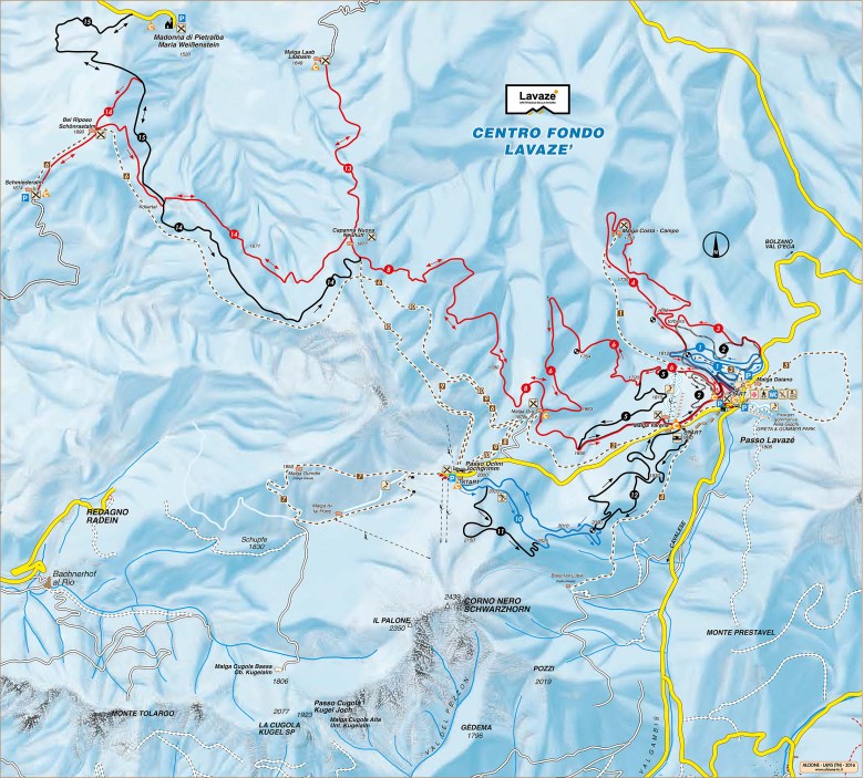
Passo di Lavazé
Ideally, the best comes last. For me, the best came last. I had so much fun up there. I remember chatting with several people on the track about how great it was. I must have have been smiling all day.
I mean: All day. Even after these 3km of constantly going up through a forest, when I finally saw what I had expected for a long time: Yet another fantastic all-around view on the mountains. At Passo di Lavazé, there are plenty.
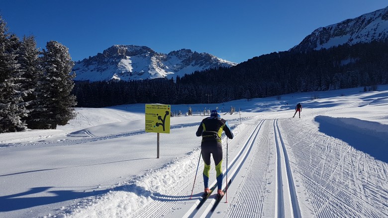
In between, you’ll always go inside and outside of forests. There is a large number of routes and most of them have several connections with each other. At every junction, there are clear signs, and there will also be a small map with a marker of your exact location and a tiny description of each loop. In between junctions, there are kilometer markings as well. The color of markings accurately corresponds with the level of difficulty.
I started with the Malga Costa track. It features a very long descent. Something like 2km. Not too steep, and the steep bits have a warning sign. There are track lines as long as you would not need to break. Track lines disappear at the spot where you would naturally leave them to have more control over breaking. I found that awesome, really. The descent leads to a restaurant, and the return way up hill has a much more gentle slope.
The Malga Ora track is similar, but it starts with a shorter descent and then a long gentle incline and ends with another long descent back to the starting area. Towards the end of the Malga Ora track, a challenging panorama track splits off. That one is 6km. Again: you go up for 3km, and then you go down. With soft snow, that’s also very doable for beginners and big fun. It’s absolutely worth the effort.
Theoretically, there is a connecting track with Deutschnofen. (Actually, with Petersberg, but then Petersberg is connected to Deutschnofen.) Practically, I wouldn’t know if it goes all the way, but the beginning of it looked well prepared. This would add another big chunk of kilometers. I was fine with what I did.
The tracks at Passo di Lavazé are in an altitude range of 1800 to 2000m. As they are partly in the forest, they are less warm than at Alpe di Siusi, but more protected from wind. And have I said that the views are stunning?


At the entrance to the tracks, you pay a day ticket. There’s also a ski rental right there, and some restaurant. Parking is not so abundant, but there’s a bigger alternative parking 200m towards the North. I did not figure if there’s a direct bus connection from Bozen, but I assume you have to change somewhere (maybe in Deutschnofen). The road was semi-cleared from the bit of snow the day before, and I still managed with summer tires. When I went down, the street service was busy clearing the street again. Still, if you got an Italian rental car, it’s better to let a day pass after strong snowfall. Or be prepared to put snow chains on.
Summary
This just needs one word: Amazing.
And then use any synonym that comes to your mind.
They could sometimes improve their signage. Restaurants are not always very visible either. Their preparation of the tracks is outstanding, and the panoramic views are a memory for life.
Give it a try.
